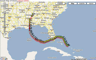
 On the following website, you will find a map of the path that Hurricane Katrina took in August 2005. In the top right hand corner you can click on the "Satellite" button and actually zoom in and see the actual building that were in Katrina's path and what it looked like before she hit. These images are older images, not live, but images before Katrina hit. Also, click on the different color balloons and you'll see the wind speed, barometric pressure, and coordinates of the location at that position.
http://compooter.org/sandbox/code/google/hurricane/atlantic/?year=2005&storm=katrina
No comments:
Post a Comment