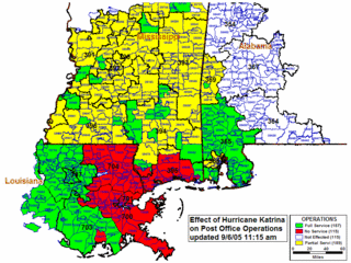
 The map to the left shows the status of all USPS Post Offices that were affected by Hurricane Katrina earlier this month (August - September 2005). Green coded areas indict fully operational post offices, yellow represents partial service, red represents NO service, while white falls into other, which is not described further. This information is as of Tuesday 9-06-05 11:15 am
Click on the map for a larger image.
No comments:
Post a Comment